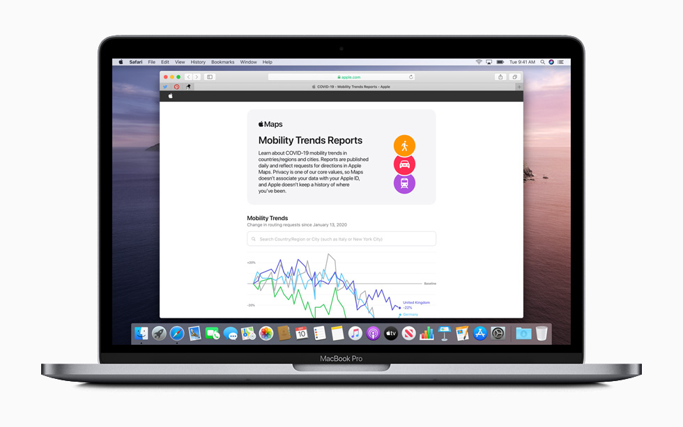
Recently, Google released a tool that could track the mobility trends of people in communities, regions and cities from the data it aggregated from Maps. The data is useful for local governments and health authorities to track the spread of the virus and now, Apple has come out with their own Mobility trends report that is based on the data it processed from Apple Maps.
The reports are published daily and will contain mobility trends for major cities and 63 countries or regions. The metric used by Apple Maps for this report is generated by counting the number of requests made to Apple Maps for directions. Using this count, Apple will compare to determine the change in volume of people driving, walking or taking public transit around the world.
Apple has stated that they are taking privacy very seriously for this tool. Maps will not associate mobility data with any user’s Apple ID and the data collected is associated with random, rotating identifiers that are continually reset. They have also put serious thought into its Bluetooth-based contact tracing app in iOS that was announced in collaboration with Google last week.
To download the Apple Mobility trends reports,click here.