Google Maps has added 12 new Indian cities which will give traffic information to drivers and commuters. Kolkata, Coimbatore, Lucknow, Surat, Thiruvananthapuram, Indore, Ludhiana, Visakhapatnam, Nagpur, Kochi, Madurai, Bhopal are the new cities that are live on Google Maps.
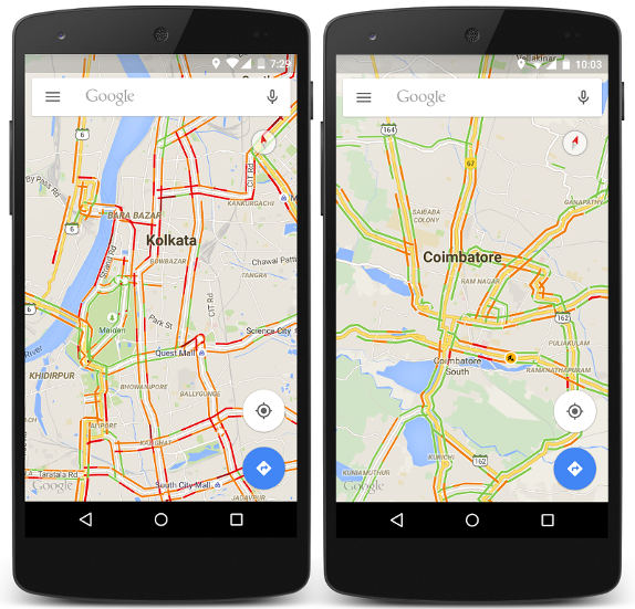
Available on both mobile and desktop versions of Google Maps, the traffic feature gives you a way to see real time traffic conditions across a total of 34 cities in India. Maps offer traffic information for all national highways and expressways in India. Once the traffic layer is turned on in Google Maps, commuters can see routes mapped out in different colors, indicating the different speed of traffic on those roads. Green means there are no traffic delays on the road, orange indicates a medium amount of traffic and red means heavier traffic congestion.
“We’re constantly working on making Google Maps a more comprehensive, daily tool for Indians, and we hope that this new real-time traffic information for 12 cities and all national highways will help drivers across the country find the best routes to their destinations with the fewest delays,”
said Suren Ruhela, Director, Program Management, Google, in a statement.
Google Maps will use real time traffic information in Navigation mode, to more accurately estimate your time of arrival and to provide options for alternate routes if there are faster options available.
Play Link – Google Maps