
Google introduced step-by-step public transit navigation directions for 400+ cities globally, back in 2011. Later it was removed. Now the feature finally back worldwide, after Google started testing if for sometime. Earlier this year Google expanded transit feature to sixteen Indian cities and also said that Google Maps globally provides over 1 billion km worth of transit results every day and has schedules for more than 2.5 million public transit stops worldwide.
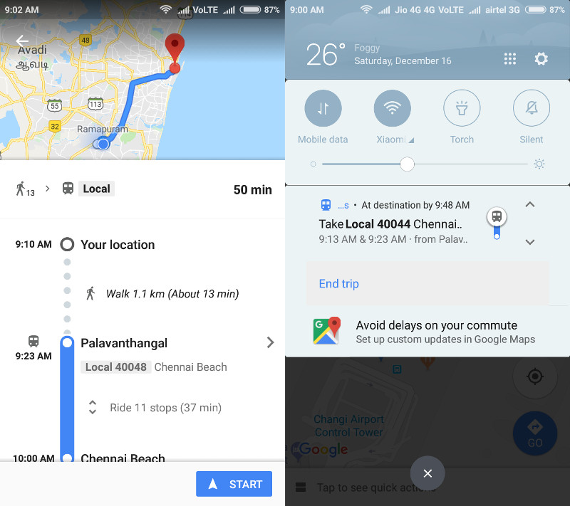
This automatically shows you stop-by-stop public transit navigation when you are traveling in a bus or train. When you search for directions for bus or train, you just have to press the ‘start’ button at the bottom of the screen that will guide your through the route. It shows display alert in notification bar and lock screen when you reach the next stop, even when you switch to other application. You can also end the trip any time if you want to get down before your final stop.
This feature will be useful for daily commuters in public transport, especially in countries like India. Google Maps recently got Two-wheeler mode in India to show directions and voice navigation for motorcycles.
Google Maps step-by-step transit navigation is now available for Android, but it should also be available for iOS users soon.